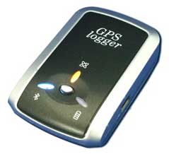
 Once you've got the GPS bug, you'll find there's a lot more than simply knowing where you are and where you're going. There's also knowing where you've been, so you can plot your bike rides in Google Earth, geolocate your trail photos after the fact, or otherwise track your movements. This requires what's known as a GPS "logger," which is either a feature in some of the higher-end handheld GPS navigation gadgets, or a stand-alone device. I’ve used two of the stand-alone variety on robotic aerial photography planes, which is admittedly a little extreme, but the conclusions are useful for anyone just going for a walk in the park.
[...]
da: http://www.kk.org/cooltools/archives/002547.php
Nessun commento:
Posta un commento